Since I last wrote, we have been making all kinds of time, hopping out on the ocean when possible, doing the other stretches on the ICW and enjoying the accompanying scenery! On the whole we have had amazing weather, which has made our northward journey so much more enjoyable than our southward journey! We essentially spent the month of November making our way south on the ICW and the month of May working our way north up the ICW. While November was basically cold and rainy, May has been sunny and hot, but generally cooling off in the evening to make for comfortable sleeping conditions!! Also, we have been early enough to have missed the 'bug season' on the ICW. We can imagine it can get pretty annoying as far as mosquitoes, flies, etc go when making your way along the winding rivers of the ICW in Georgia and the Carolinas, - not to mention anchoring - in July and August!!
We left Charleston on a beautiful day early in the morning, with northwesterly winds blowing at 15-20 knots. We reefed in the main and put out half a jib, leaving the 'iron jib' on duty, as we kept falling in to the 6' swells and losing our momentum. It was important that we keep an average speed of about 5 knots as we had 65 miles to go before our anchorage in Wynah Bay, just outside of Georgetown, South Carolina. By noon, the wind had died down and the sea had flattened to a lovely leisurely swell. The Wynah Bay entrance is well marked and deep but long!! We dropped anchor in the marshes about 7:30pm and had a wonderful, peaceful night!
shrimp boat coming home to Charleston after a night on the water
Wynah Bay marshes
Wynah Bay anchorage
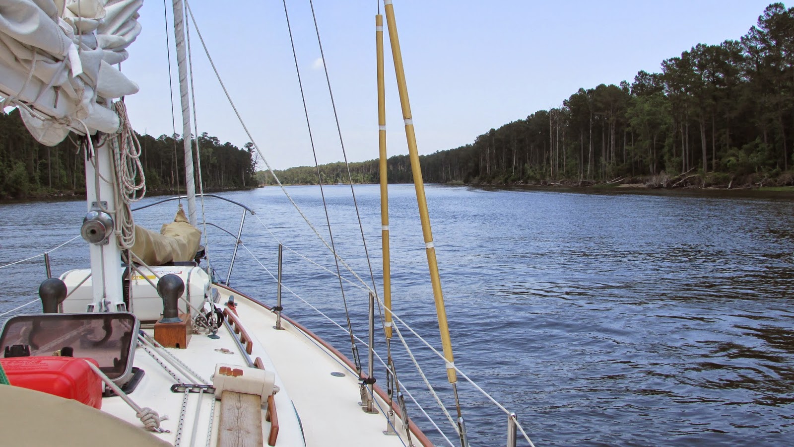
The next day we decided to stay inside and take the Waccamaw River to Cape Fear. This route had been recommended to us and we are so glad we took it! Lovely, winding river with lots of cypress trees lining the banks. We found another amazing anchorage on one of the may ox-bows off the main river, and again, spent a peaceful, quiet night at anchor.
The following are a selection of photos along the Waccamaw River.
"...and the moss hung thick from the cypress trees, like sausage on the smokehouse wall..."
Woke to serene, sunny weather, and made our way past Myrtle Beach through countryside that reminded us very much of the Cape Cod area, with all the sand dunes and grasses, until we reached Little River, where we anchored again....another quiet night!! We are getting very spoiled! We had another opportunity to go outside the next morning, but the tides were not in our favour and the winds had picked up, so decided to stay inside one more day to make Southport. Southport is the main centre south of Cape Fear. From there we cut across the Cape using the Cape Fear River and then into the Masonboro Inlet, to Wrightsville Beach where we re-provisioned before heading back out to the Atlantic.
Little River sunset
Grand Dunes/Myrtle Beach area
fishing at one of the inlets off the coast of North Carolina
Once again, got an early start to catch the tide and were on our way out of the Masonsboro Inlet, heading to Morehead City off the Beaufort Inlet. Today, winds bounced around a lot, from 5-20 knots, but essentially remained from the southwest on our port quarter, while the swells gradually grew bigger and bigger from the east on our starboard quarter!! Fortunately, they remained fairly 'soft', with about a 4 second frequency, so never got too uncomfortable, but at 10' or so, the biggest waves we have seen so far! By the time we reached the Beaufort Inlet, we were getting concerned that the waves could be a problem, but in fact, they presented no worries at all, as the shallows on the south side of the inlet broke them down completely! We made our way to Portside Marina in Morehead City, where we were met by very friendly staff, free loner bikes and free laundry!! Whoo Hoo! We were only staying one night, but the free laundry was great!
I tried to capture the swells at the end of the day, but that is hard to do!! By the end of the day, some of the rollers were hitting about 10 feet, but averaging about 8 feet, however, I don't think the video does them justice!! Fair warning though, I hope it doesn't cause any seasickness!!
The next morning was blowing pretty hard, however still behind us, so the waves coming in the inlet were behind us as we made our across the Beaufort Inlet and back on to the ICW, heading up the Beaufort Inlet, across the Newport River, and ultimately up the Neuse River. The wind and weather was so great, we were able to motor sail up the Neuse toward our planned anchorage off Bay River, however, our updated weather showed some pretty massive storm cells to our south, and we were worried they may try to catch up to us, so we decided to press on to a more protected anchorage in Eastham Creek, off Goose Creek Canal. As it turned out, the weather moved east, so missed us entirely, but meanwhile we had yet another quiet anchorage!!! Another front did pass through during the night, but did nothing worse than give us some wind.
ICW enroute to the Neuse River
Goose Creek canal
The next morning dawned sunny and cool, and after a relaxing coffee and fruit salad, we headed out on to the Pamlico River, where we took advantage of the 10 knot winds and sailed across, and up, the Pungo River, past Bellhaven, and on to an anchorage just at the south end of the Pungo River Canal. Nice, quiet anchorage...filled with flies!!!! Fortunately, we have screens on all our ports and hatches, so were able to take comfortable refuge inside the boat for the evening after killing off the numerous flies that tried to crash the cocktail hour!!!!
Too cool for flies the next morning, so got away unmolested, and made our way up the Pungo River/Alligator River Canal. We had hoped to sail up the Alligator River, but the winds were too light and on our nose, so motored up to the Alligator River Bridge. At which point, we decided to carry on across the Albemarle Sound, as the wind was now in our favour but the water had not had time to kick up too much! After crossing the Sound, the wind switched completely and started blowing from the SW, essentially blowing on our starboard quarter, blowing us all the way up the mouth of the Pasquotank River to Elizabeth City, where we were made welcome at the Mid-Atlantic Christian University on their free docks! We had made about 60 nm that day, so felt very good about the day!
The next morning we got away early again and headed up the rest of the Pasquotank River. What a beautiful morning and what a beautiful river!! Probably our favourite portion of the ICW. The river is lovely, winding its way through the last of North Carolina before we locked into the Dismal Swamp Canal at the Southport Locks at 11:00am. It was here that we met the rest of our fellow boaters travelling the Dismal Swamp and we had about 6 other boats go through the locks with us. We then travelled along the old Dismal Swamp Canal, first proposed as a canal by George Washington in 1763 when it was called the Washington Ditch. We were travelling on the Memorial Day weekend, so saw lots of kayakers and canoeists on the canal, as it is an excellent waterway for that kind of travel! We actually had a kayaker ride our wake for a couple of miles!! We reached the Deep River bridge before the locks in plenty of time for the 3:30 opening, and then stopped at the docks between the lock and the bridge. Only one other boat there, so a nice quiet stop and a relatively early day!!
Here are some photos of the beautiful Pasquotank River!!
early morning fishing on the Pasquotank
comin' round the bend!
cypress tree
The Dismal Swamp Canal
lush growth along the edge of the canal at this time of year!
the slow.....
.....and the fast!!!
The next day we locked through the Deep River lock at 8:30am and made our way through the busy, industrial harbour of Norfolk, VA, ultimately stopping at the Sunset Boat Yard, where we had started our ICW adventure almost exactly 7 months ago! We had hoped to continue making good progress, sailing outside Delaware, however, the winds are predicted to be north, north-easterly, with thunderstorms over the next four days. Because of that, we will make our way back up the Chesapeake Bay tomorrow, hoping to stay out of high winds and big seas by hugging the eastern shore and planning for long days to get us to the C and D canal, and then take advantage of the north winds to blow us down the Delaware Bay and in to Cape May, NJ where we will have one more outside over-nighter to get to New York. We're on the home stretch now!
Wow!! We are SO HAPPY we stopped here! This has been a great place to visit!
We left Fernandina fairly early in the morning in fairly chilly weather, surprisingly! However it warmed up quickly and we had a very nice day travelling through the Georgian Low Country. (So called because it is essentially marsh, with the odd small island, which are called hammocks.) We both remarked on how nice it was to travel this leg in the sunshine, as the last time we had been through in November, it was pretty miserable....cold and rainy!!
Georgia Low Country
wild horse on Cumberland Island
Jekyll Island is one of the barrier islands along the coast of Georgia, and is not far from Fernandina, so the fact that we left early meant that we arrived at the Jekyll Island Marina by lunch time....plenty of time to take advantage of the bicycles the marina has for it's guests and start to explore the many beautiful bicycle paths on the island! Having these bicycles available for us to borrow made all the difference to our visit! Every day we were there we hopped on the bikes and soaked up the casual, beautiful ambiance of the island, riding through gorgeous maritime forests with huge live oaks dripping with spanish moss and casting their cool shade over the path. The island itself is only about 7 miles long, but there are over 20 miles of bicycles paths weaving all over the island, travelling through the forests, around the historic district where the wealthy used to play, and along the sand dunes where sea turtles lay their eggs. There is a six mile toll bridge that connects Jekyll Island with the mainland of Georgia, which effectively keeps vehicular traffic down to a minimum on the island, so although there is virtually no need to ride your bike on the road, there is so little traffic that the roads are in excellent condition and very quiet. While there are numerous stop signs, there are no traffic lights anywhere on the island. Jekyll Island is one of very few places where golf carts drive safely on the road, without hindering the flow of traffic! Both the bicycle paths and the roads wind casually around the trees instead of ploughing through them, making for a relaxed and pleasant approach to transportation!
'Don't feed the alligators'!!!
bicycle paths
Magnolia Tree
Live Oak with spanish moss
Driftwood Beach
maritime forest
Atlantic Beach
The historic district is 240 acres of homes and landscapes that date from the 1920's when the wealthy elite such as the JP Morgans, the Rockefellers, the Vanderbilts, the Cranes, the Goodyears, and many other 'movers and shakers' in the business and banking world decided to create an exclusive club, with a maximum of 100 members where they and their families and guests could come and relax undisturbed. The Jekyll Island Clubhouse is still on the property and is now a hotel where you can stay if you like! A number of the families built their own 'cottages' nearby, and those, too, have been restored and are open to the public as museums, or have been converted in to gift shops and art stores. The houses and Clubhouse were abandoned when WWII broke out, and none of the families returned! Because the island was so isolated, the buildings lay derelict for a number of years before the government stepped in to preserve it. They also decreed that in order to safe-guard the local flora and fauna, they would not allow any more than 35% of the island to be developed, which means that 65% of the island is still in a 'natural' state! They are presently building three more hotels on the ocean side, however they can only build where there was already an existing hotel, so that too, is being controlled.
Rockefeller cottage
Jekyll Island Club
Croquet on the Jekyll Island Croquet Lawn
street in the historic district
All that activity helped us to work up enough of an appetite that we were easily able to justify sharing a pound of fresh shrimp for supper on the wharf, at a pub called The Rah Bar, and then having another pound the following day for lunch!!
casual, but delicious Georgian shrimp!
Suffice to say, I took way too many pictures, and we had some great bike rides during our stay and thoroughly enjoyed ourselves! However, the proverbial 'weather window' was opening very nicely for us to sail outside again and make our way to Charleston, SC, so regretfully, we said our goodbyes and headed back out in to the Atlantic in the early hours of May 7.